Top left Section Top right Section Middle left Section Middle right Section Bottom left Section Bottom right Section
|
Aspects of Kentish Local History |
| Home News & Events |
Publications | Archaeological Fieldwork |
Local
& Family History |
Information by Parish |
Kent Maps and Tithe award schedules, apportionment etc.
A
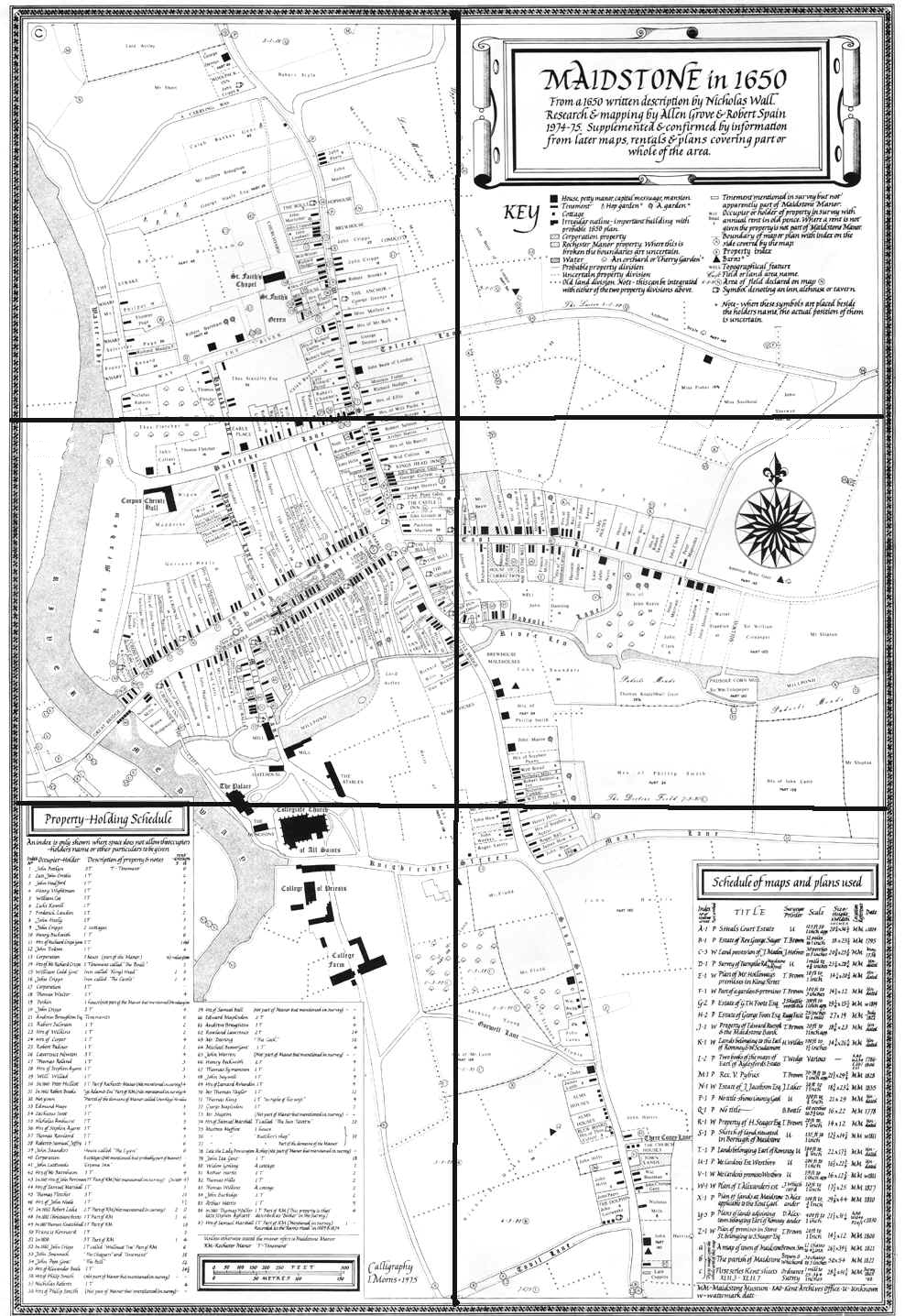
Map of Maidstone in 1650 from a written description
by Nicholas Wall.
Research and mapping by Allen Grove
and Robert Spain 1974-75. Supplemented and confirmed by
information from later maps, rentals and plans covering part or whole
of the area. Map measures 43 cm. x 62 cm.
By kind permission of Robert Spain and the Maidstone Area Archaeological
Group
Top left Section Top right Section Middle left Section Middle right Section Bottom left Section Bottom right Section
Top left Section Top right Section Middle left Section Middle right Section Bottom left Section Bottom right Section
Back to Maidstone Maps etc Back to List of Kent Maps, Tithe awards/schedules
This website is constructed
by enthusiastic amateurs. Any errors noticed by other researchers will be
to gratefully received
so that we can amend our pages to give as accurate a record as
possible. Please send details too localhistory@tedconnell.org.uk