Ash next Ridley - Parish Information
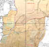
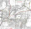
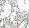
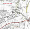
1936
25inch maps of New Ash Green overlain with Tithe Maps
To view individual maps click on the thumbnail picture
 |
 |
 |
 |
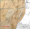 |
| 26
x 27cm |
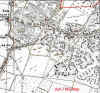
NW
- 37 x 36cm |
NE
- 31 x 36cm |
SW
- 37 x 35cm |
SE
- 31 x 35cm |
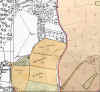
| 1839
Ash Tithe Map - solid overlay |
|
 |
 |
 |
 |
 |
| 26
x 27cm |
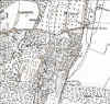
NW
- 37 x 36cm |
NE
- 36 x 36cm |
SW
- 37 x 35cm |
SE
- 36 x 35cm |
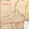
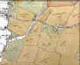
| 1839
Ash Tithe Map - with neighbourhoods showing |
Back
to Before New Ash Green
Back
to Ash next Ridley Researches Introduction
Back
to Information by Parish Introduction
This website is
constructed by enthusiastic amateurs. Any errors noticed by other
researchers will be to gratefully received so
that we can amend our pages to give as accurate a record
as possible. Please send details too
localhistory@tedconnell.org.uk
|