The discovery
and excavation of a Late Iron-Age and Early Roman Farmstead at
Viewpoint, Wellfield, Hartley, Kent 1975/76 and 1984
TQ6084/6842
Excavation
Overview
Mechanical stripping of the topsoil in November / December 1975 with a
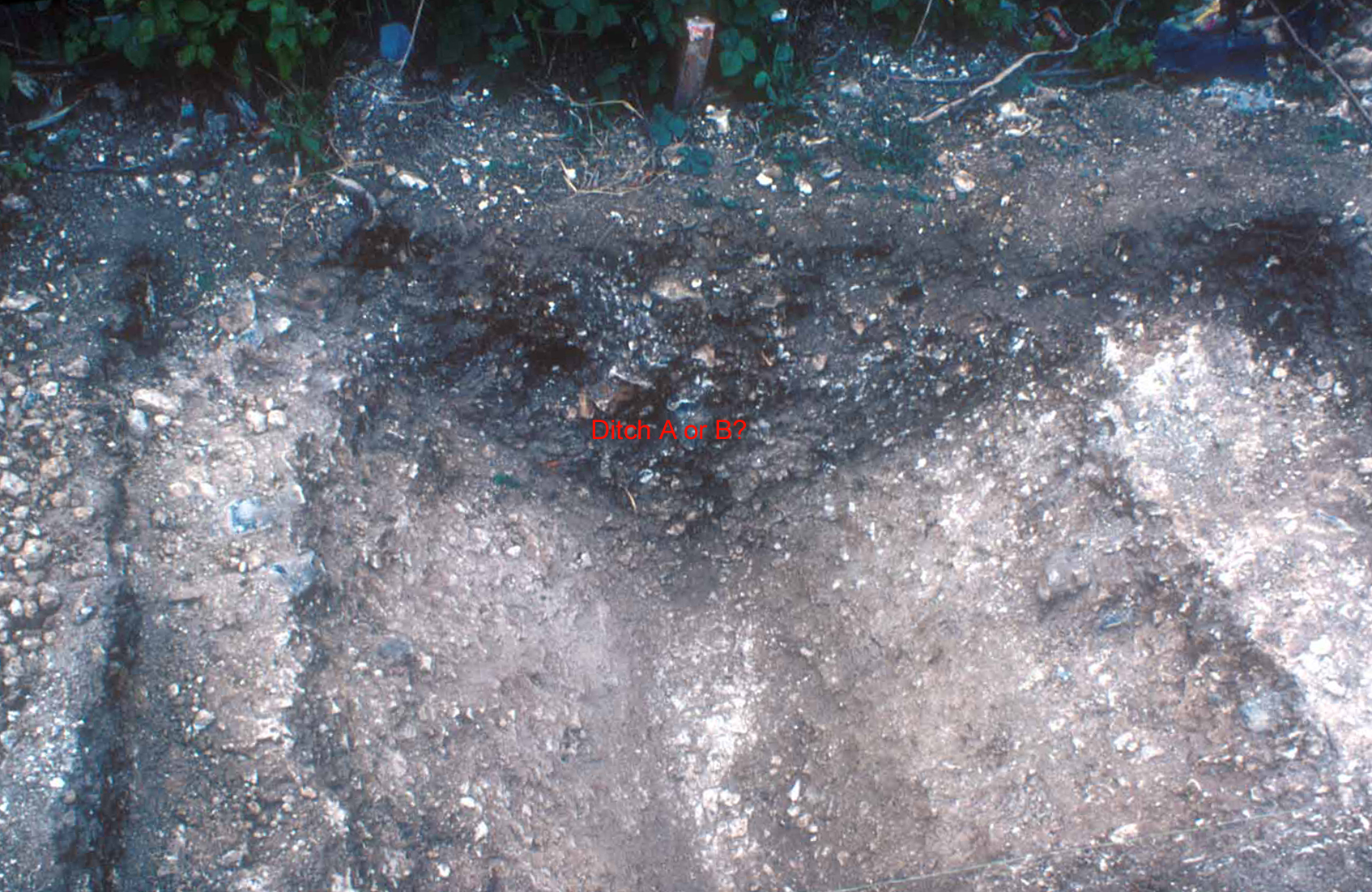
J.C.B. over an area of approximately 140 square metres revealed a curving ditch
C, and initially another ditch A, which on excavation was found to be a recut of
an earlier ditch B. A tiled hearth was discovered overlying Ditch A. During the
total excavation of Ditches A and B, an earlier Pit F was discovered. During the
building of Block 9 to the north, Ditches G and J, and Pit H were also
discovered.
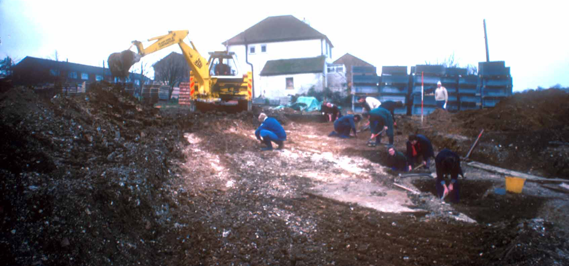
Further excavations in 1984 following the demolition of the house
View Point, led to the discovery of further lengths of Ditches A and B and Pit
K.
The kerbs of the south-western end of the road formed a
right-angle. The east to west kerb was taken as a base line for a grid layout
from which measurements were taken.
Ditches A and B, the tiled heath and Pit F
The face of the terrace cut by the construction of the road was
cleaned up, and a cut 1½m wide in Ditch A was excavated producing pottery and
animal bones. The line of the ditch seemed to head towards the house View Point.
A trench was dug with a J.C.B. adjacent to the house across the suspected line
of Ditch A and instead located Ditch B, approximately 22m south-west from the
road kerb, along the expected line of Ditch A.
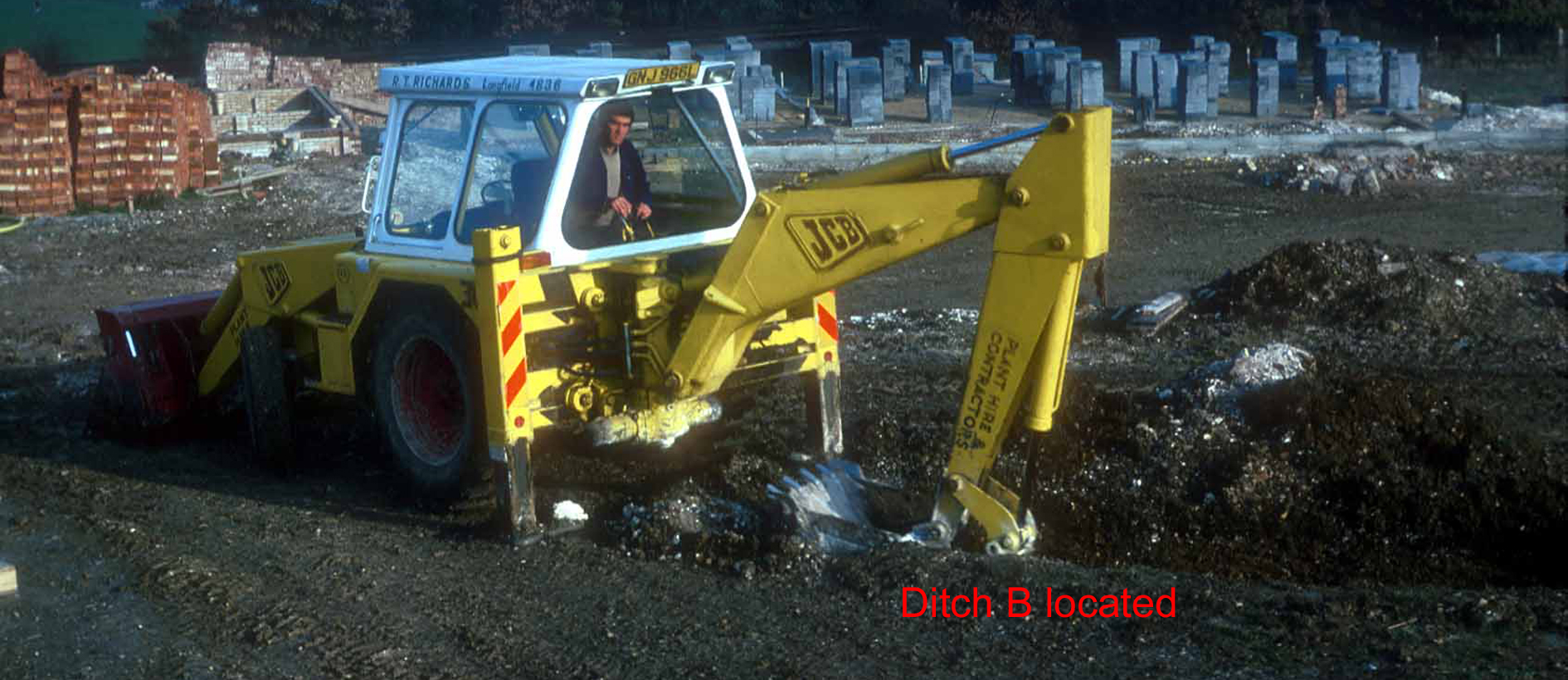
J.C.B. Excavating trench over line of ditch B
The outline of the proposed house block (now nos. 35/37
Caxton Close) was laid out on the ground in orange tape to show the area
that was going be destroyed by the excavation of the footings.
Outline of proposed house block marked with
orange tape
The topsoil was removed from the
area by J.C.B., from the terrace edge south towards the house View Point.
Ditch A was measured from the
road edge south-west along its length and marked out in 1m portions for
excavation, leaving ½m baulks in between to be excavated later.
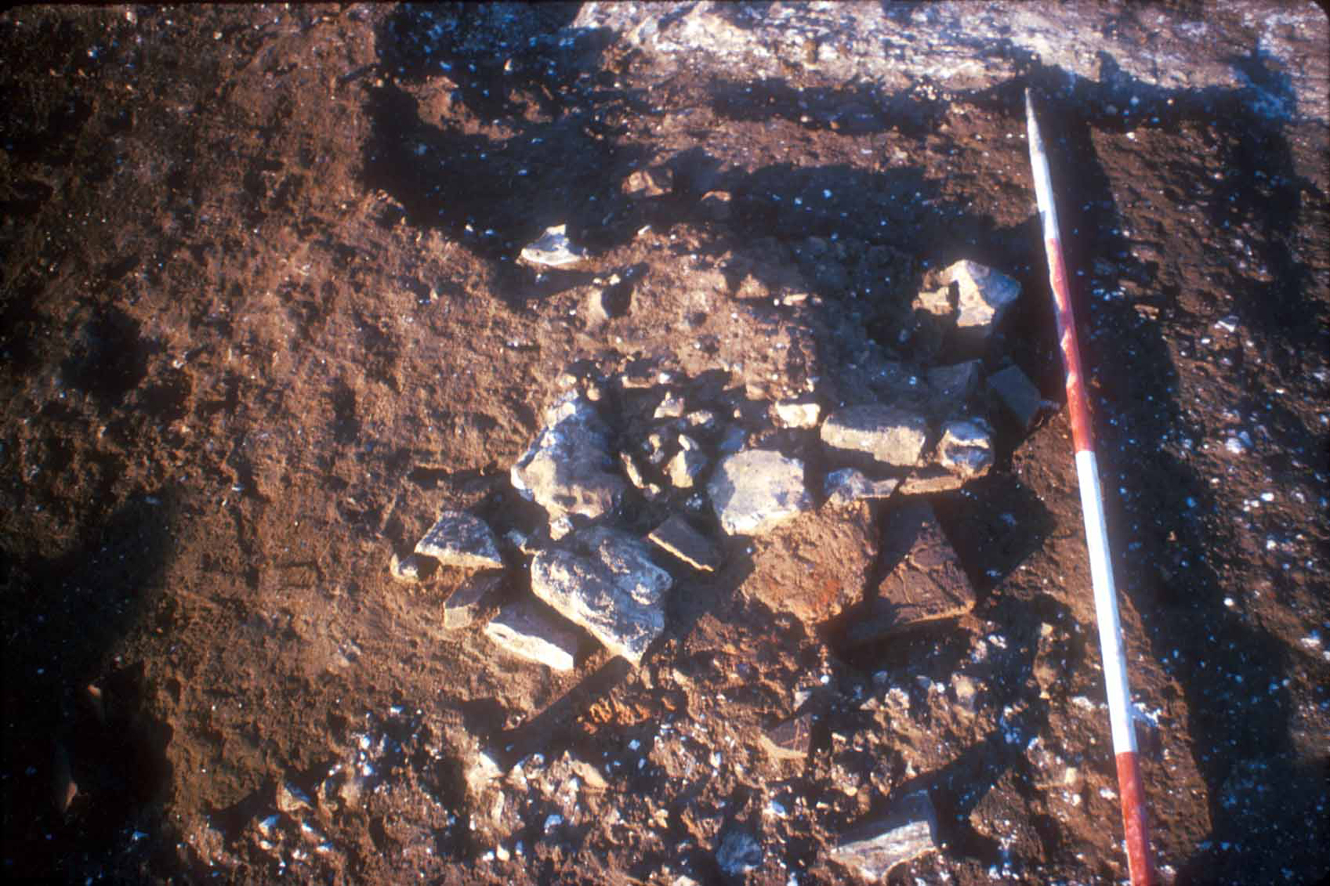
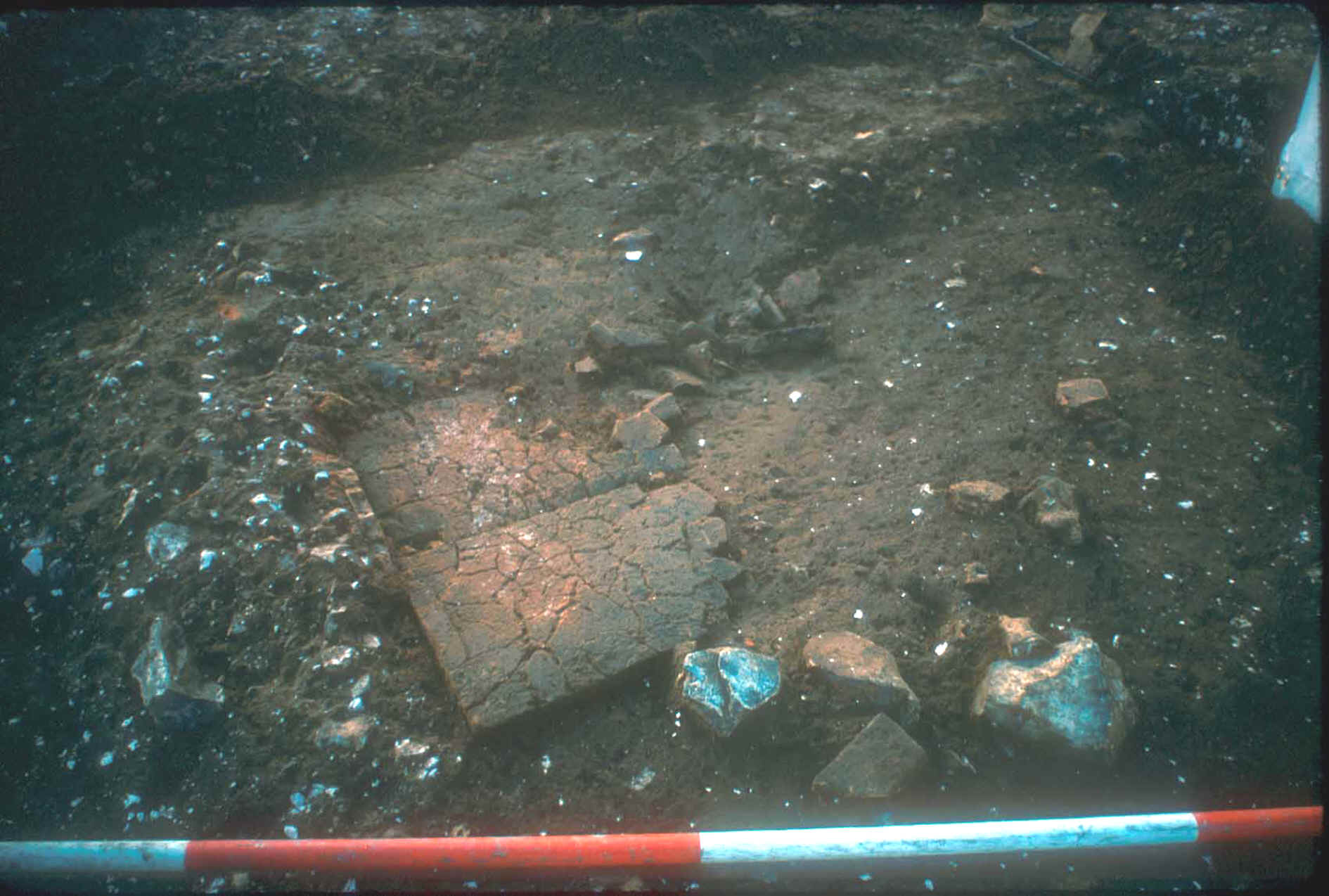
During the trowelling of the remaining topsoil overlying the ditch,
a mass of burnt clay with flints and a piece of quernstone were discovered,
situated over the line of Ditch A. Cleaning up and excavation of the clay
revealed what had been two complete Roman tegula roof tiles laid upside down to
form the base of a hearth or oven. The intense heat from many fires had
shattered them both into many pieces.
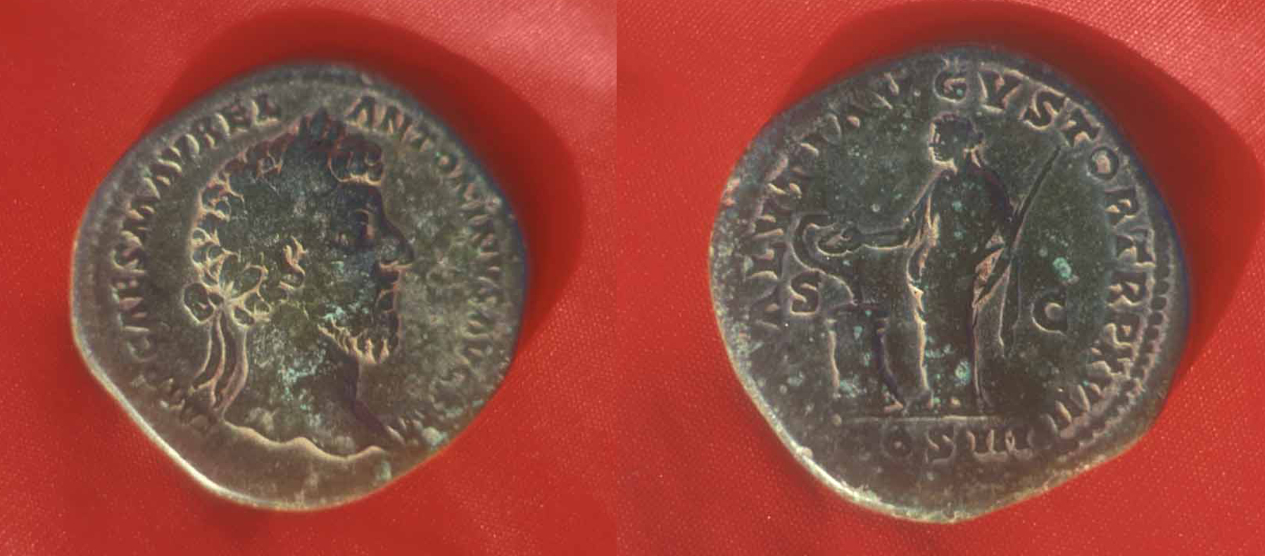
Also found by Charlie Capes whilst cleaning back
the topsoil just to the north of the hearth was a bronze coin, a sestertius of
Marcus Aurelius, AD 162-163 (TR P XVII). The reverse shows Salus standing left,
feeding snake entwined round an altar. The catalogue reference is RIC 843 (Roman
Imperial Coinage). Rome mint.
Obv : IMP CAES M AVREL ANTONINVS AVG P M
Rev : SALVTI AVGVSTOR TR P XVII COS III S C
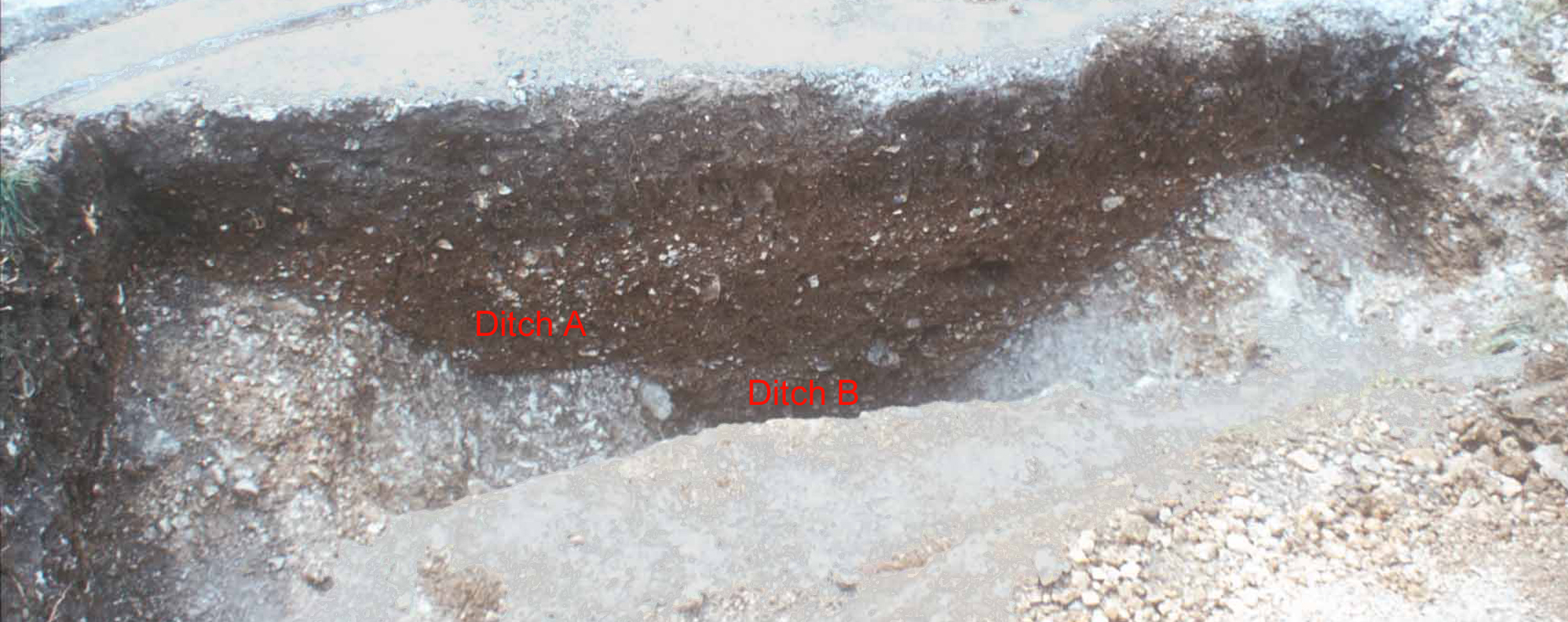
Excavation of Ditch A at various points along
its length revealed that a Ditch B, with a V shaped profile, had been dug first
and stretched for 22½m from the road edge up to the edge of our excavation near
the house View Point. Over time this had been allowed to fill up.
At a later time Ditch A had been dug, with a shallow U shaped
profile slightly to the south-east of Ditch B, but only ran some 16m from the
road edge and terminated leaving Ditch B to carry on.
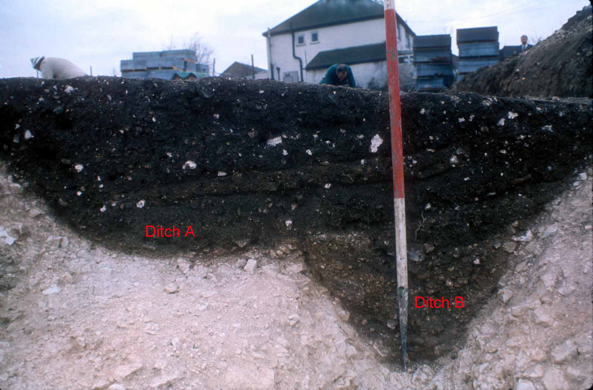
Ditches A and B
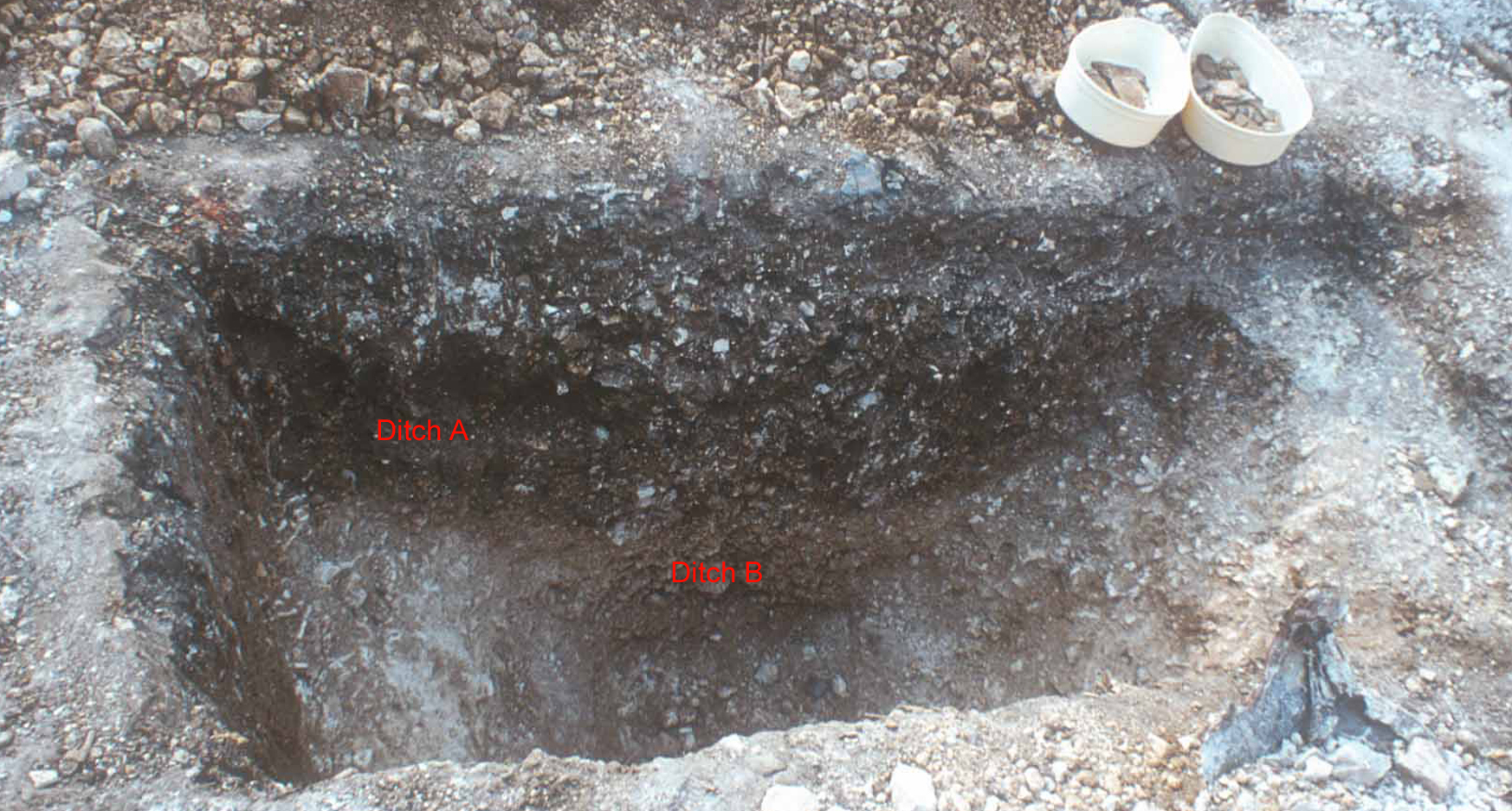
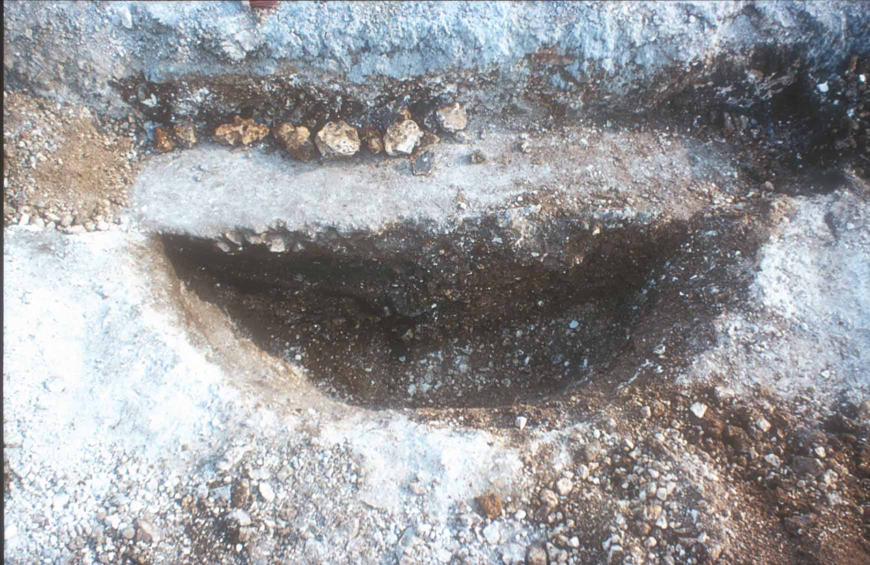
Pit F was also discovered during excavation of
Ditches A and B. The edge of it had already been cut through by Ditch B.
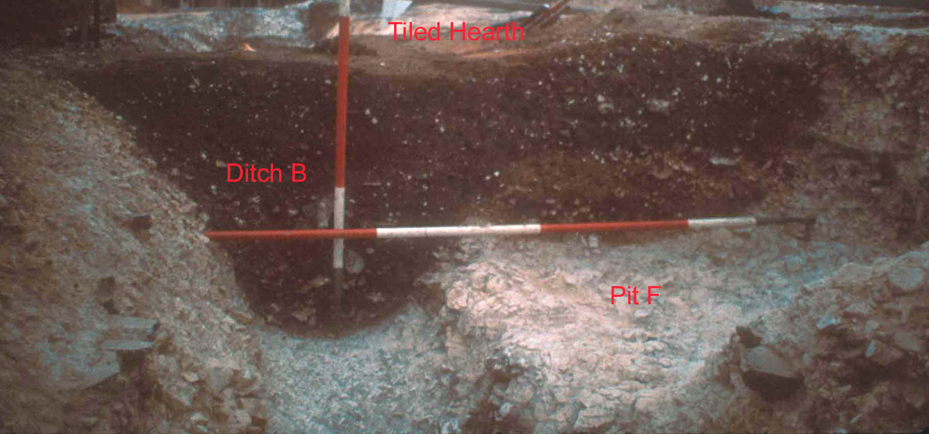
Pit F cut by ditches A and B, with pit S
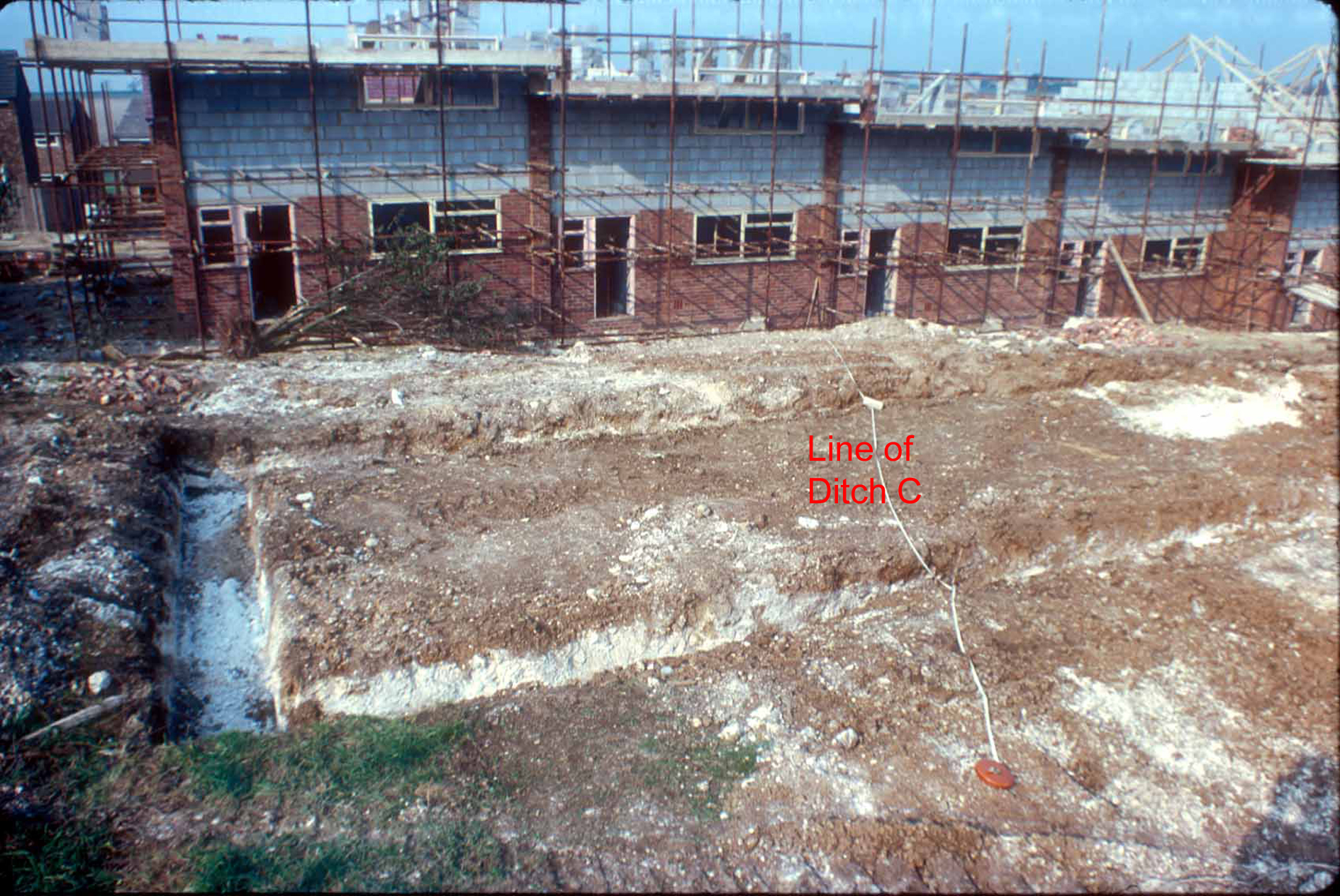
Ditch C
With further stripping of topsoil, some 19 metres of Ditch C
was revealed. The ditch was divided into 2m portions, measured from the southern
edge of the area cleared of topsoil, running north towards the road. Initially
1½m cuts were excavated leaving ½m baulks to be excavated later. Except for a
modern pit 2m wide, the rest of the ditch some ¾m deep into the chalk, produced
pottery, ranging in date from the late 1st century to the late
2nd century, animal bone and oyster shell.
The ditch does not seem to have remained open for much natural
weathering to take place and was possibly backfilled and levelled all in one
operation.
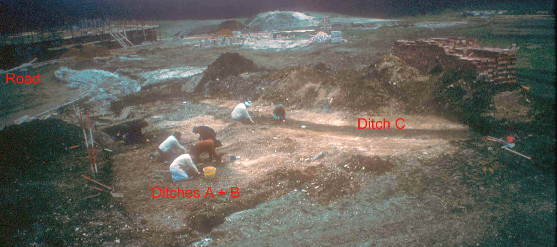
Ditches A and B to left. Ditch C curving in
the background
Over the next ten weekends the majority of the
contents of 7 metres of Ditches A & B, and Pit F were fully excavated. Ditch
C was also completely excavated except for 2m of the modern pit.
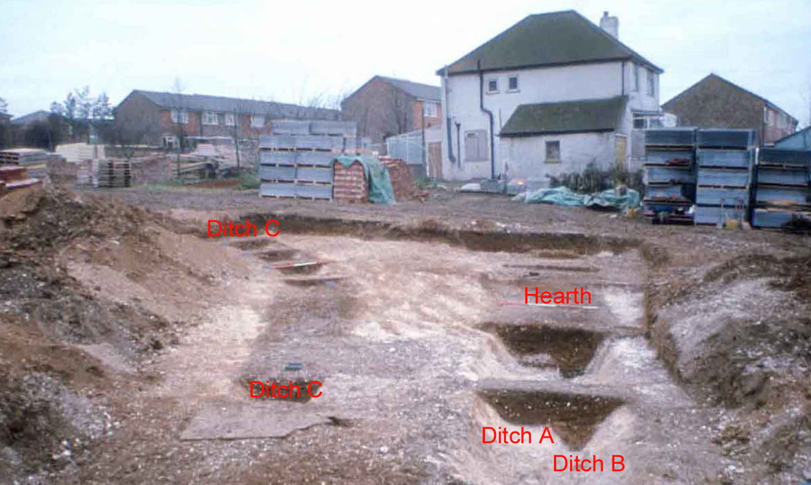
Ditches A, B, C and hearth
By the 25th January 1976 the excavation of
Ditches A, B & C, and Pit F was complete and the work of construction on the
block (now nos. 17 to 37 Caxton Close) was started.
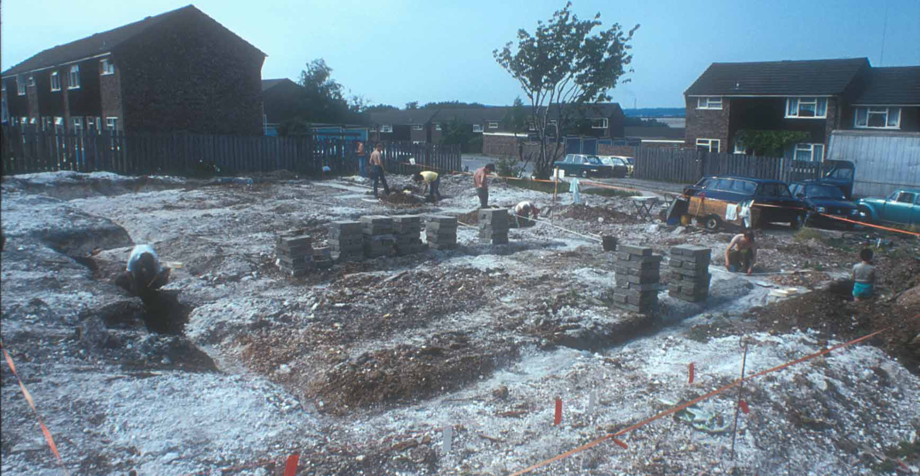
Ditches G & J, and Pit H
During the week of 19th January the footing trenches for Block
9 (now nos.39/41 Caxton Close) had been dug. Ditch G could be seen
entering the footing trench from the west and exiting through the north-eastern
edge. Ditch J could be seen entering the footing trench from the east side of
Block 9 and curving round to leave on the south side.
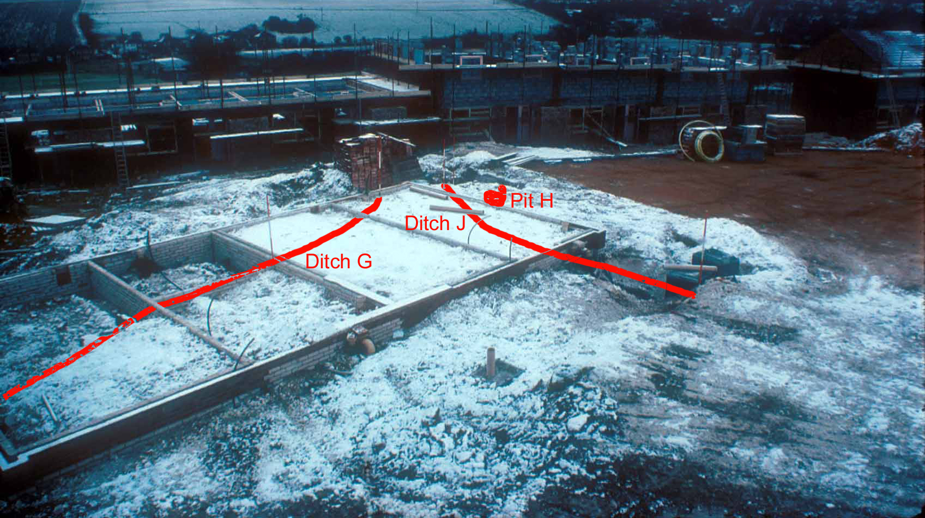
Ditches, G, J and pit H in the snow
A trench for services dug just to
the east of Block 9 revealed Pit H. It was narrower at the top, widening out at
the bottom, the shape of a classic bee-hive shaped Iron Age grain storage pit,
later used as a rubbish pit. The date was confirmed by the late Iron Age pottery
excavated.
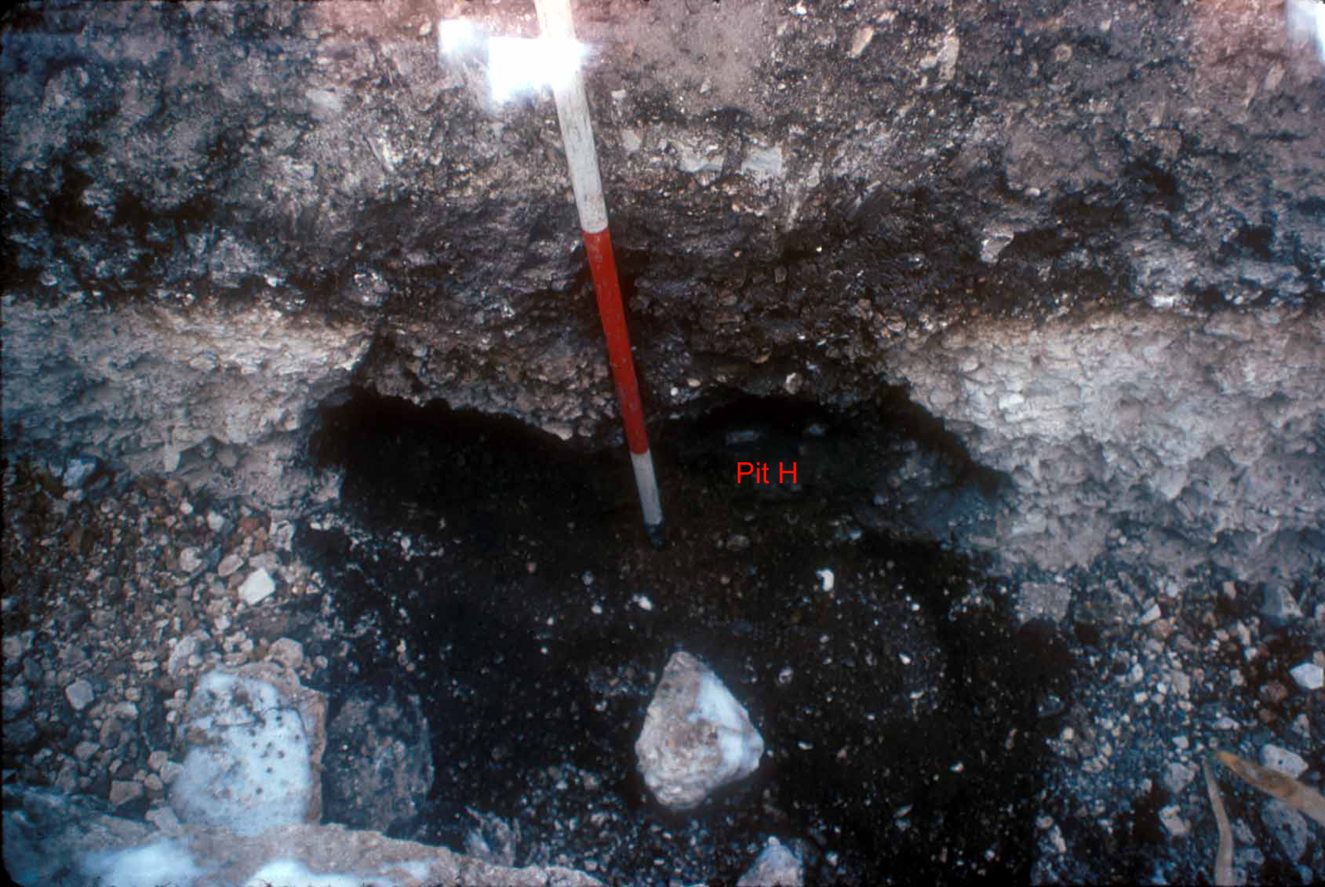
Pit H cut by service trench
With the excavation of Pit H, work was completed on the site and
we left the builders to get on with the work of building the houses.
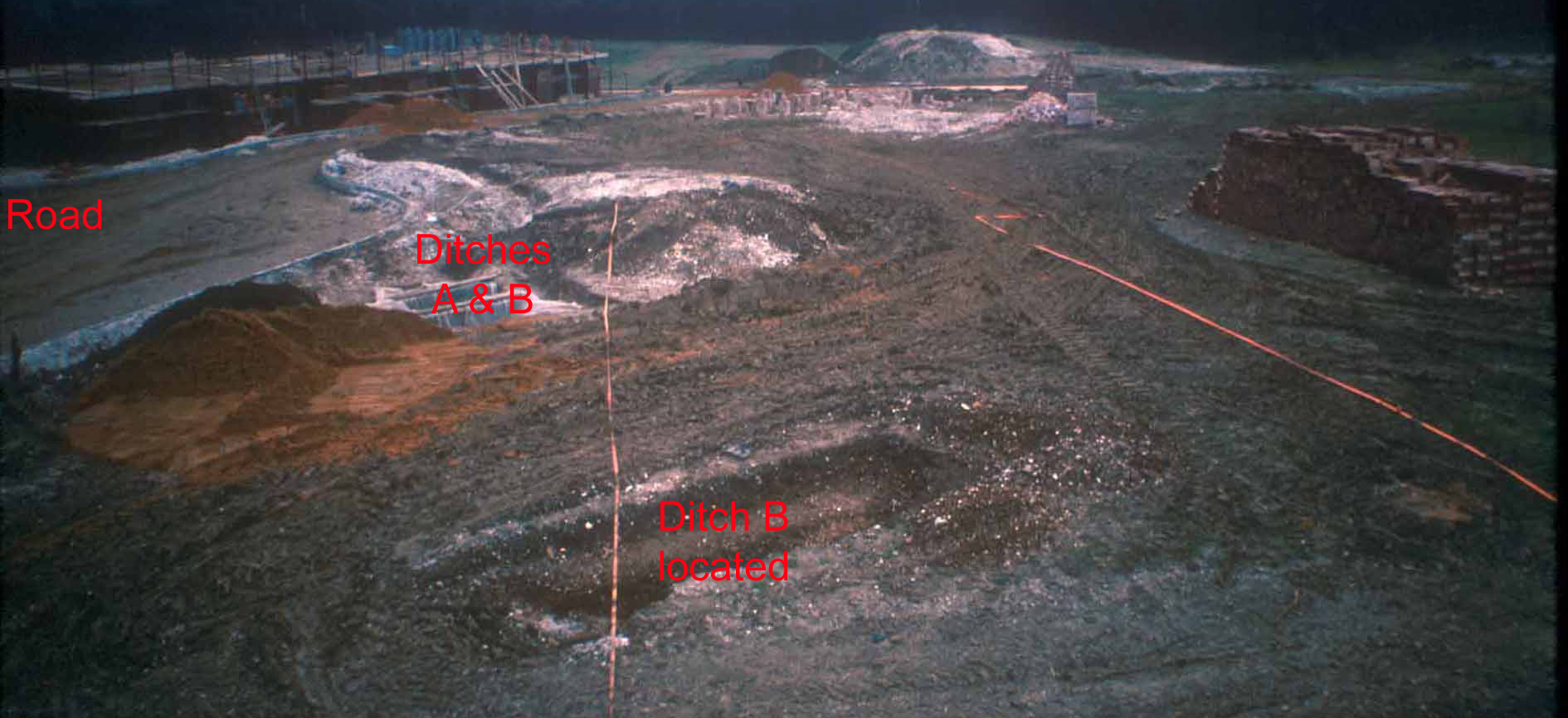
Later in 1976 the footing trenches for garages to the south of
Block 10 (now nos. 17 to 37 Caxton Close) revealed Ditch C carrying on
southwards.
Continuation of ditch C showing in garage
footing trenches
- - - - - - - - - - - -- - - - - -- - - - - -- - - - - -- - -
- - -- - - - - -- - - - - -- - - - - -- - - - - -- - - - - -- - -
In July 1984 the old house, View Point
was demolished to make way for new housing (now nos. 28/30 + 40/42). On
Sunday 22nd July 1984 in glorious sunshine, as opposed to the freezing
conditions in 1975/76, members of the Fawkham & Ash Archaeological Group
returned for one day to record the features encountered during the construction
of the foundations for the new houses.
Concreted footing trenches cutting extension
of ditch A and B, plus pit K on left
Excavation this time was carried out in five
boxes. On excavation Box D revealed that both Ditches A & B had continued.
It is probable that Ditch A had been interrupted by a causeway entrance.
Certainly the presence of so much domestic rubbish indicated that the main
living area was not far away.
Ditches A and B
Box C 4m further west again
revealed that both Ditches A & B continued.
Ditches A and B
But Box A another 6m further west right up
against the fence of house no. 26 Pitfield, found just one shallow ditch cut
into the chalk, possibly Ditch A.
Ditch A
On the south-west side Box E, Pit K had been cut
through by the house foundations. Pottery dating to the 1st and 2nd century A.D.
and animal bone were found.
Pit K
At the end of the day, work was completed on the
site and we left the builders to get on with the work of building the houses.